|
||||||
|
||||||
| Create Mountain And Ocean | ||||||
|
||||||
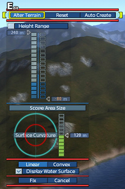
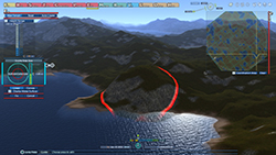
| 【Height Range】 Turn on to set the maximum and minimum height to edit terrain. Hover the cursor over a bar. Then press × button and the up or down directional buttons / left-click / use the scroll wheel to adjust a height. Left bar: Set the maximum height. Right bar: Set the minimum height. 【Scope Area Size】 Set areas to edit at one time. Area editting bar: Hover the cursor over the bar, and press × button and the up or down directional buttons / left-click / use the scroll wheel to change areas. [Linear]: Form flat mountain slopes. [Convex]: Form rounded mountain slopes. [Display Water Surface]: Show or hide the surface of the water. [Fix]: Once fixed, editted terrain will appear and costs will be payed. Costs will be displayed as [Cost] in the [Geo] menu. [Cancel]: By cancellation, tentative and uncompleted data also deleted. |
 |
|||||
| Continuous Motion | ||||||
| Press and hold L1 button or R1 button for continuous motion of editting. 【With mouse】 If the mouse has side buttons and able to select go to next or previous by the buttons, press and hold buttons for continuous motion. |
||||||
| © 2010-2020 ARTDINK. All Rights Reserved. *Please enable JavaScript in your browser to view all content on this site. |
||||||
